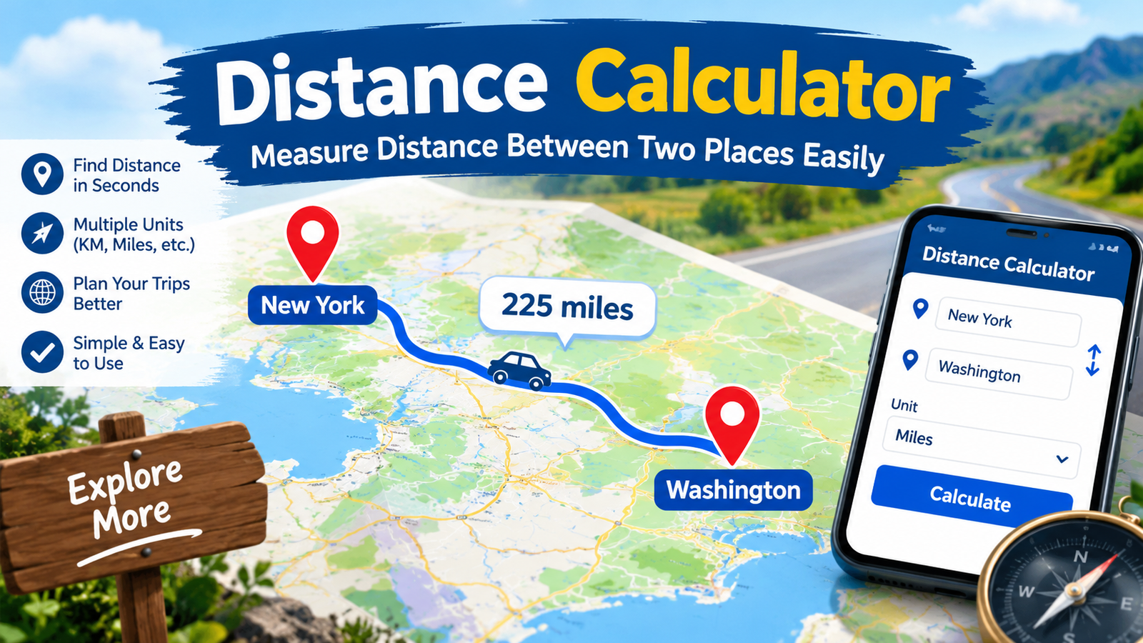
Distance Calculator: Measure Distance Between Two Places Easily
Have you ever wondered how far one place is from another? You may want to plan a road trip, find the distance between two cities, or measure the space between locations. A distance calculator can help you find these answers quickly. It makes distance measurement simple for students, travelers, drivers, and everyday users.
You do not need special tools or advanced math skills. Most online calculators only require two locations or their coordinates. Some tools also show driving routes, travel distances, and estimated journey times. Others calculate the direct distance between two points on a map.
Understanding these results can help you plan better and save time. You can compare routes, estimate fuel needs, and prepare for upcoming trips. In this guide, you will learn how distance calculations work, which methods are available, and how to choose the right tool for your needs.
What Is a Distance Calculator?
A distance calculator is an online tool that measures the distance between two or more points. Depending on its features, it may use city names, street addresses, map locations, or geographic coordinates. The result can appear in kilometers, miles, meters, or feet.
For example, you might want to know how far your home is from your school. Entering both locations can provide a distance estimate. Some calculators measure a straight line between the points. Others follow roads and suggest practical travel routes.
These methods provide different results because roads rarely follow straight lines. A direct measurement may be shorter than the actual driving distance. Therefore, understanding the type of measurement is important. Choose a tool that matches your goal, whether you are studying geography, planning a trip, or checking the distance between nearby places.
How Does a Distance Calculator Work?
Most distance calculators use one of two main methods. The first method measures the direct distance between two geographic points. The second method calculates the distance along a road network or another mapped route.
For direct measurements, the tool may use latitude and longitude. These coordinates identify a location on Earth. A mathematical formula then estimates the distance between the points while accounting for Earth’s curved surface.
Road-based tools use digital maps and road information. They identify possible paths between the selected locations. The total distance depends on the chosen route and available roads.
For example, two towns might be 80 kilometers apart in a straight line. However, a winding road may make the driving distance 105 kilometers. Both results can be correct because they measure different things. Always check whether your result represents direct distance or route distance before using it.
Types of Distance Calculators
Different calculators serve different purposes. Selecting the correct type helps you get a useful answer without unnecessary steps.
Here are some common options:
- Straight-line distance calculator: Measures the shortest direct distance between two points.
- Driving distance calculator: Measures distance along roads suitable for driving.
- Walking distance calculator: Finds routes designed for pedestrians.
- Flight distance calculator: Estimates direct geographic distance between airports or cities.
- Coordinate distance calculator: Uses latitude and longitude values.
- Map distance calculator: Measures distances using selected locations on a digital map.
- Unit conversion calculator: Converts distances between miles, kilometers, meters, and other units.
Each option has a different purpose. A traveler may need road distances, while a geography student may need direct measurements. A fitness enthusiast might prefer a walking or running route. Before calculating, consider what you want to measure and how you plan to use the result.
How to Calculate Distance Between Two Locations
Calculating the distance between two places is usually easy. First, choose a reliable online tool that supports your preferred measurement method. Next, enter the starting location and destination in the correct fields.
If the tool supports addresses, use complete names whenever possible. Adding a city or region can help prevent confusion between places with similar names. For coordinate-based calculations, enter the correct latitude and longitude values.
After submitting the details, review the displayed result. Check the measurement unit and determine whether the result represents direct distance or a travel route. Some tools provide additional information, including alternative routes and estimated journey times.
For example, suppose you want to visit a friend in another city. A direct measurement helps you understand the geographic separation. A road-based result gives you a more practical estimate for driving. Comparing both can improve your planning and help you understand why different tools sometimes show different numbers.
Straight-Line Distance vs. Driving Distance
Straight-line distance and driving distance describe two different measurements. Straight-line distance measures the direct separation between two points. It does not follow roads, rivers, bridges, or other obstacles.
Driving distance follows a road network. It considers the available connections between the starting point and destination. Roads may bend around hills, buildings, rivers, and other barriers. This often makes the driving distance longer.
Imagine two towns separated by a large lake. Their direct distance might be only 20 kilometers. However, drivers may need to travel 45 kilometers to reach a suitable bridge. The road distance is longer because vehicles cannot travel directly across the water.
Both measurements are useful in different situations. Use direct distance for geography, basic comparisons, and coordinate calculations. Choose driving distance when planning a road trip or estimating fuel needs. Knowing the difference helps you avoid confusion and make better decisions.
How to Measure Distance Using Latitude and Longitude
Latitude and longitude are geographic coordinates used to identify places on Earth. Latitude measures a location north or south of the equator. Longitude measures its position east or west of the prime meridian.
A coordinate-based distance calculator uses these values to estimate the separation between two points. This method is helpful when you know exact coordinates but do not have a complete street address.
For example, a researcher may record the coordinates of two observation points. Entering both sets of coordinates can reveal their approximate geographic distance. The same approach can help with mapping projects, outdoor activities, and educational exercises.
Many tools use the Haversine formula for this calculation. It estimates the great-circle distance between two points on a spherical Earth. This gives a useful result for many everyday purposes. However, specialized surveying may require more precise methods that account for Earth’s shape and local measurement conditions.
Distance Calculator for Travel Planning
Travel planning becomes easier when you know how far you need to go. A distance calculator can help you compare destinations, review possible routes, and estimate the effort required for a journey.
For road trips, use a driving distance tool rather than relying only on direct distance. Review the suggested route and check whether it includes highways, toll roads, or unusual detours. You should also consider traffic, road closures, and weather conditions.
For air travel, direct distance between airports can provide a useful starting point. However, actual flight paths may differ because of air traffic, weather, and operational requirements.
For example, a family planning a weekend trip may compare two destinations. One location might be geographically closer but require a longer drive. Another might offer a shorter road route and fewer stops. Comparing travel distances helps you make a practical choice. Remember that calculated distances are estimates, and real travel conditions can change your journey.
Miles, Kilometers, and Other Distance Units
Distance can be measured in several units. The best choice depends on your location, activity, and preferred measurement system.
Kilometers are widely used in many countries for road distances. Miles are common in places such as the United States. Meters and feet are useful for shorter measurements, while centimeters and inches are often used for very small distances.
Here are some helpful conversions:
| Unit | Equivalent |
| 1 kilometer | 1,000 meters |
| 1 mile | Approximately 1.609 kilometers |
| 1 kilometer | Approximately 0.621 miles |
| 1 meter | Approximately 3.281 feet |
| 1 foot | 0.3048 meters |
A distance calculator may let you switch between units automatically. This feature is useful when comparing travel information from different sources. For example, a route listed as 50 miles equals about 80.47 kilometers. Checking the units carefully prevents mistakes when planning trips or comparing measurements.
Benefits of Using an Online Distance Calculator
An online distance calculator offers several benefits. It can save time, simplify calculations, and help users understand geographic distances without complicated manual work.
One major advantage is convenience. You can often calculate distances using a phone, tablet, or computer. Many tools also provide quick results without requiring advanced mathematical knowledge.
Another benefit is better planning. Travelers can compare destinations and routes before leaving home. Students can check geography exercises, while runners can explore distances between points. Businesses may also use distance measurements for delivery planning and location comparisons.
However, the quality of the result depends on the information entered and the tool’s features. An incorrect address can produce an incorrect measurement. A basic calculator may not account for road conditions or restricted routes.
For the best results, use accurate starting points and destinations. Check the unit and calculation method before relying on the answer. A calculator is most helpful when you understand what its result actually represents.
Common Mistakes to Avoid When Calculating Distance
Even a simple calculation can produce confusing results when you use the wrong information. One common mistake is entering an incomplete location. Several places may share the same name, so adding a city or region can improve accuracy.
Another mistake is confusing direct distance with road distance. A straight-line result does not tell you exactly how far you must drive. Always select the appropriate method for your purpose.
Incorrect coordinates can also affect the result. Check the latitude and longitude values carefully, especially when copying them from another source. A misplaced decimal point can create a large difference.
Finally, do not assume that distance alone determines travel time. Traffic, road quality, speed limits, weather, and stops can all affect a journey. Even a reliable route estimate may change during the day.
To avoid these problems, review your inputs and confirm the measurement type. If the result seems unusual, compare it with another trusted mapping service. This simple habit can help you make more informed decisions.
How to Choose the Best Distance Calculator
The best distance calculator depends on what you need to measure. A simple tool may be enough for checking the direct distance between two locations. Travel planning may require a service with road maps and route options.
Look for a clear interface that makes entering locations easy. The tool should display results in understandable units. If you work with coordinates, confirm that it supports latitude and longitude.
For drivers, useful features include route alternatives and road-based measurements. For walkers, pedestrian routes may be more suitable. Students and researchers may prefer tools that show geographic distances without focusing on road travel.
Accuracy is also important. Check whether the calculator explains its measurement method. Consider whether the results are estimates and whether the tool uses current map information.
Privacy deserves attention, too. Avoid entering sensitive location details into unfamiliar websites without reviewing their privacy practices. A good tool should be easy to understand, suitable for your task, and transparent about the information it provides.
Practical Examples of Distance Calculation
Real-life examples make distance calculations easier to understand. Imagine that your school is three kilometers from home. You might use a map-based tool to estimate the walking route and decide when to leave.
Now imagine planning a trip between two cities. A direct measurement shows their geographic separation. A road-based calculation may show a longer distance because the available roads follow a different path.
Distance calculations can also help with exercise. If you want to walk five kilometers, a route tool can help you choose a path with a suitable length. You can then compare your planned distance with your activity tracker after completing the walk.
Small businesses can use route distances when comparing delivery locations. However, they should also consider traffic, delivery schedules, and vehicle limits.
These examples show that distance measurements support many everyday decisions. The key is choosing the correct calculation method and treating the result as a useful estimate rather than a guarantee.
Distance Calculator: Tips for More Accurate Results
Getting a useful result starts with choosing accurate location details. Enter the complete names of both places whenever possible. If the tool accepts street addresses, include enough information to identify the correct destination.
When using coordinates, verify the order of latitude and longitude. Some systems display coordinates in decimal degrees, while others use degrees, minutes, and seconds. Enter them in the format required by the tool.
Next, choose the correct distance type. Use a direct geographic measurement for point-to-point comparisons. Use a road-based route when planning a drive. For walking, select a pedestrian route if available.
Review the result and its units before making decisions. If the distance seems incorrect, check your entries and compare another source. For longer journeys, review road closures and travel conditions separately.
These steps can reduce confusion and improve your planning. Remember that even accurate geographic measurements cannot predict every real-world obstacle. Use the result alongside current maps and other relevant information for the best outcome.
Frequently Asked Questions
1. What is a distance calculator used for?
A distance calculator measures the separation between two or more locations. Depending on its features, it can calculate direct geographic distance, road distance, walking routes, or distances based on coordinates. People use these tools for travel planning, education, exercise, business tasks, and everyday location comparisons.
2. How can I calculate the distance between two cities?
Enter the names of both cities into a suitable online tool. Choose direct distance if you want their geographic separation. Select a road-based option if you need the driving distance. Check the displayed units and confirm that the tool has identified the correct cities before using the result.
3. Is straight-line distance the same as driving distance?
No, these measurements are different. Straight-line distance measures the direct separation between two points. Driving distance follows available roads. Rivers, mountains, highways, and road layouts can make the driving distance much longer than the direct measurement.
4. Can I calculate distance using latitude and longitude?
Yes. Many calculators accept latitude and longitude coordinates. Enter the coordinates for both locations, following the required format. The tool then estimates the geographic distance between them. This method is useful for mapping, education, research, and other tasks involving precise location points.
5. Can a distance calculator estimate travel time?
Some tools provide estimated travel times alongside route distances. These estimates may depend on road layouts, typical speeds, or available traffic information. Actual travel time can change because of congestion, weather, stops, and road closures. Always check current conditions before starting an important journey.
6. Are online distance calculators accurate?
Online calculators can provide useful results when you enter correct information and choose the appropriate method. However, accuracy varies by tool and purpose. Direct geographic measurements differ from road distances, and route information may become outdated. For important measurements, compare reliable sources and use specialized equipment when necessary.
Conclusion
A distance calculator is a simple and useful tool for measuring the separation between places. It can help you plan trips, compare routes, understand geographic locations, and convert distance units. The right tool makes these tasks faster and easier.
Before calculating, decide whether you need a straight-line measurement, a driving route, or a coordinate-based result. Enter accurate details and check the units carefully. Remember that travel distances and times may change with road conditions and other real-world factors.
With these basic steps, you can use distance measurements more confidently. Whether you are planning a family trip, studying geography, or choosing a walking route, a suitable calculator can help you make better decisions.